Ottumwa Regional Airport | |||||||||||||||
|---|---|---|---|---|---|---|---|---|---|---|---|---|---|---|---|
 | |||||||||||||||
| Summary | |||||||||||||||
| Airport type | Public | ||||||||||||||
| Owner | City of Ottumwa | ||||||||||||||
| Serves | Ottumwa, Iowa | ||||||||||||||
| Elevation AMSL | 845 ft / 258 m | ||||||||||||||
| Coordinates | 41°06′24″N 092°26′53″W / 41.10667°N 92.44806°W | ||||||||||||||
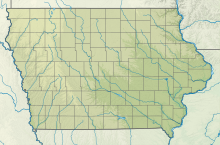
| Map | |||||||||||||||
 | |||||||||||||||
| Runways | |||||||||||||||
| |||||||||||||||
| Statistics | |||||||||||||||
| |||||||||||||||
Ottumwa Regional Airport[1][2] (IATA: OTM, ICAO: KOTM, FAA LID: OTM), formerly Ottumwa Industrial Airport, is six miles northwest of Ottumwa, in Wapello County, Iowa.[1] The airport is owned by the City of Ottumwa and is operated by the Airport Advisory Board. It is listed as a general aviation airport in the National Plan of Integrated Airport System (NPIAS) and as an Enhanced Service Airport in the Iowa Aviation System Plan.[3]
- ^ a b c FAA Airport Form 5010 for OTM PDF. Federal Aviation Administration. Effective Jan 5, 2017.
- ^ Ottumwa Regional Airport Archived 2009-10-13 at the Wayback Machine. City of Ottumwa. Accessed 14 October 2009.
- ^ "Airport Summary Report: Ottumwa Industrial Airport" (PDF). Iowa Aviation System Plan. 2004.

