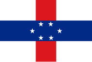

The following outline is provided as an overview of and topical guide to the Netherlands Antilles:
Netherlands Antilles – former autonomous Caribbean country within the Kingdom of the Netherlands, consisting of two groups of islands in the Lesser Antilles: Aruba, Curaçao and Bonaire, in Leeward Antilles just off the Venezuelan coast; and Sint Eustatius, Saba and Sint Maarten, in the Leeward Islands southeast of the Virgin Islands. Aruba seceded in 1986 as a separate country within the Kingdom of the Netherlands, and the rest of the Netherlands Antilles was dissolved on 10 October 2010,[1] resulting in two new constituent countries, Curaçao and Sint Maarten, with the other islands joining the Netherlands as special municipalities.[2]
- ^ "Status change means Dutch Antilles no longer exists". BBC. 2010-10-10. Retrieved 2010-10-10.
- ^ "Antillen opgeheven op 10-10-2010" (in Dutch). NOS. 1 October 2009. Retrieved 1 October 2009.

