| Owens River | |
|---|---|
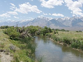
 Owens River south of Poverty Hills | |
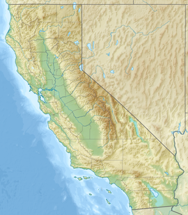
 Map of the Owens Lake watershed, including Los Angeles Aqueduct system | |
| Location | |
| Country | United States |
| State | California |
| District | Mono County, Inyo County |
| Cities | Mesa, Bishop, Big Pine, Elna (site), Chrysopolis (site), Independence, Lone Pine |
| Physical characteristics | |
| Source | Confluence of Deadman Creek and an unnamed stream |
| • location | Inyo National Forest, Mono County |
| • coordinates | 37°45′01″N 118°56′20″W / 37.75028°N 118.93889°W[2] |
| • elevation | 7,251 ft (2,210 m) |
| Mouth | Owens Lake |
• location | A few miles northwest of Keeler, Inyo County |
• coordinates | 36°32′31″N 117°58′45″W / 36.54194°N 117.97917°W[2] |
• elevation | 3,592 ft (1,095 m) |
| Length | 183 mi (295 km), north-south |
| Basin size | 2,604 sq mi (6,740 km2) |
| Discharge | |
| • location | Big Pine, CA[3] |
| • average | 389 cu ft/s (11.0 m3/s)[3] |
| • minimum | 51.9 cu ft/s (1.47 m3/s) |
| • maximum | 3,220 cu ft/s (91 m3/s) |
| Basin features | |
| Tributaries | |
| • left | Spring Valley Wash, Silver Canyon Creek, Coldwater Canyon Creek |
| • right | Hot Creek, Rock Creek, Bishop Creek, Big Pine Creek, Birch Creek, Independence Creek, Lone Pine Creek |
| Designated | March 30, 2009 |
The Owens River is a river in eastern California in the United States, approximately 183 miles (295 km) long.[4] It drains into and through the Owens Valley, an arid basin between the eastern slope of the Sierra Nevada and the western faces of the Inyo and White Mountains. The river terminates at the endorheic Owens Lake south of Lone Pine, at the bottom of a 2,600 sq mi (6,700 km2) watershed.
In the early 1900s, the Owens River was the focus of the California Water Wars, fought between the city of Los Angeles and the inhabitants of Owens Valley over the construction of the Los Angeles Aqueduct. Since 1913, the Owens River has been diverted to Los Angeles, causing the ruin of the valley's economy and the drying of Owens Lake. In winter 2006, the Los Angeles Department of Water and Power restored 5% of the pre-aqueduct flow to the river by court order, allowing the Owens River Gorge, the river bed in the valley, and Owens Lake to contain a small amount of water.[5]
- ^ "Query Form For The United States And Its Territories". U.S. Board on Geographic Names. Retrieved 2010-05-13.
- ^ a b c "Owens River". Geographic Names Information System. United States Geological Survey, United States Department of the Interior. 1981-01-19. Retrieved 2010-06-05.
- ^ a b "USGS Gage #10227500 on the Owens River near Big Pine, CA". National Water Information System. U.S. Geological Survey. 1975-12-19. Retrieved 2011-12-15.
- ^ U.S. Geological Survey. National Hydrography Dataset high-resolution flowline data. The National Map, accessed March 17, 2011,
- ^ "L.A. Returns Water to the Owens Valley". NPR.org. NPR
