Ozark | |
|---|---|
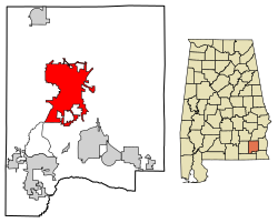
 Location of Ozark in Dale County, Alabama. | |
| Coordinates: 31°26′53″N 85°38′31″W / 31.44806°N 85.64194°W | |
| Country | United States |
| State | Alabama |
| County | Dale |
| Settled | 1822 |
| Incorporated | October 27, 1870 |
| Government | |
| • Type | Mayor/City Council |
| • Mayor | Mark Blankenship |
| Area | |
• Total | 34.34 sq mi (88.94 km2) |
| • Land | 34.10 sq mi (88.33 km2) |
| • Water | 0.23 sq mi (0.61 km2) |
| Elevation | 417 ft (127 m) |
| Population (2020) | |
• Total | 14,368 |
| • Density | 421.30/sq mi (162.66/km2) |
| Time zone | UTC-6 (Central (CST)) |
| • Summer (DST) | UTC-5 (CDT) |
| ZIP Codes | 36360-36361 |
| Area code | 334 |
| FIPS code | 01-57648 |
| GNIS feature ID | 0152832 |
| Website | www |
Ozark is a city in and the county seat of Dale County, Alabama. As of the 2010 census, the population of the city was 14,907.[2]
Ozark is the principal city of the Ozark Micropolitan Statistical Area, as well as a part of the Dothan-Ozark Combined Statistical Area. Ozark was originally a part of Enterprise–Ozark micropolitan area before being split,[3] and for a longer while was part of the Dothan-Enterprise-Ozark combined statistical area but Enterprise later became its own separate primary statistical area in later censuses.[4][5] Fort Novosel, the primary flight training base for Army Aviation, abuts Ozark.
- ^ "2020 U.S. Gazetteer Files". United States Census Bureau. Archived from the original on October 27, 2021. Retrieved October 29, 2021.
- ^ "Geographic Identifiers: 2010 Demographic Profile Data (G001): Ozark city, Alabama". U.S. Census Bureau, American Factfinder. Retrieved October 2, 2015.[dead link]
- ^ "Table 1. Annual Estimates of the Population of Metropolitan and Micropolitan Statistical Areas: April 1, 2000 to July 1, 2009 (CBSA-EST2009-01)". 2009 Population Estimates. United States Census Bureau, Population Division. March 23, 2010. Archived from the original (CSV) on March 26, 2010. Retrieved March 24, 2010.
- ^ "Dothan-Enterprise-Ozark, AL Combined Statistical Area" (PDF) (Map). www.2census.gov. US Census Bureau. Archived (PDF) from the original on December 14, 2021. Retrieved December 14, 2021.
- ^ "OMB Bulletin No. 20-01: Revised Delineations of Metropolitan Statistical Areas, Micropolitan Statistical Areas, and Combined Statistical Areas, and Guidance on Uses of the Delineations of These Areas" (PDF). United States Office of Management and Budget. March 6, 2020. Archived (PDF) from the original on April 20, 2020. Retrieved September 21, 2020.

