 Mount Pagan, the most active of the two stratovolcanoes on Pagan Island in 1983 | |
 | |
| Geography | |
|---|---|
| Location | Pacific Ocean |
| Coordinates | 18°7′N 145°46′E / 18.117°N 145.767°E |
| Archipelago | Northern Mariana Islands |
| Area | 47 km2 (18 sq mi)[1] |
| Length | 16.2 km (10.07 mi) |
| Width | 6.0 km (3.73 mi) |
| Highest elevation | 570 m (1870 ft) |
| Highest point | Mount Pagan |
| Administration | |
United States | |
| Commonwealth | Northern Mariana Islands |
| Demographics | |
| Population | 7 (2018) |
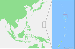
Pagan is a volcanic island in the Marianas archipelago in the northwest Pacific Ocean, under the jurisdiction of the Commonwealth of the Northern Mariana Islands. It lies midway between Alamagan to the south and Agrihan to the north. The island has been largely uninhabited since the majority of the residents were evacuated due to volcanic eruptions in 1981.
The volcano on Pagan is monitored by the USGS, which issues weekly updates about volcanic activity.[2] The island actually has two stratovolcanoes, one on the north and another in the south.[3]
- ^ "13 PAGAN" (PDF). National Oceanic and Atmospheric Administration. p. 68. Archived (PDF) from the original on 15 November 2020. Retrieved 15 November 2020.
- ^ https://volcanoes.usgs.gov/volcanoes/pagan/status.html [bare URL]
- ^ "Pagan Island, Northern Marianas". earthobservatory.nasa.gov. 2012-03-26. Retrieved 2023-10-12.