Paletwa
ပလက်ဝမြို့ | |
|---|---|
Town | |
 | |
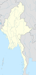
| Coordinates: 21°18′N 92°51′E / 21.300°N 92.850°E | |
| Country | |
| State | |
| District | Matupi District |
| Township | Paletwa Township |
| Area | |
• Total | 1,368 sq mi (3,543 km2) |
| Population (2014) | 96,899 |
| Time zone | UTC+6.30 (MST) |
| Climate | Am |
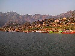
Paletwa (Burmese: ပလက်ဝမြို့; MLCTS: pa. lak wa. mrui., pronounced [pəlɛʔwa̰ mjo̰]) is one of the westernmost towns of Myanmar, in Chin State 18 kilometres from the border with Bangladesh. From the other side of the border, lies Chittagong Division of Bangladesh. Paletwa town's population in 2014 was about 97,000.[1]
The Arakan Army launched an attack at the town on November 13, 2023 and captured it on 15 January, 2024 during the Myanmar Civil War.[2]
