| Palisades Dam | |
|---|---|
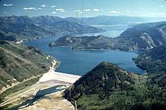
 Aerial view from northwest | |
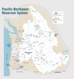
Location in Idaho | |
| Official name | Palisades Dam |
| Country | United States |
| Location | Bonneville County, Idaho |
| Coordinates | 43°19′59″N 111°12′10″W / 43.33306°N 111.20278°W |
| Construction began | 1951 |
| Opening date | 1957 |
| Operator(s) | U.S. Bureau of Reclamation |
| Dam and spillways | |
| Impounds | Snake River |
| Height | 270 feet (82 m) |
| Length | 2,100 feet (640 m) |
| Dam volume | 13,571,000 cu yd (10,376,000 m3) |
| Spillway type | Radial gates to tunnel through left abutment |
| Spillway capacity | 48,500 cu ft/s (1,370 m3/s) |
| Reservoir | |
| Creates | Palisades Reservoir |
| Total capacity | 1,200,000 acre-feet (1.5 km3) |
| Catchment area | 5,150 sq mi (13,300 km2) |
| Normal elevation | 5,620 ft (1,713 m) |
| Power Station | |
| Hydraulic head | 249 ft (76 m) |
| Turbines | 4 x 44.15 MW turbines |
| Installed capacity | 176.6 MW |
| Annual generation | 906,720,100 KWh (1994) |
 | |
Palisades Dam (National Inventory of Dams ID ID00273) is an earth-fill dam in the western United States, on the upper Snake River in eastern Idaho. Located in Bonneville County near the Wyoming border, the dam was completed 67 years ago in 1957.
Providing irrigation water, flood control, and recreation, it features a four-turbine hydroelectric power plant and can potentially generate 176.5 MW of electricity. The resulting water impoundment, Palisades Reservoir, has a storage capacity of 1.2 million acre-feet. The dam and power station were listed on the National Register of Historic Places in 2018.

