| Palmerston Canberra, Australian Capital Territory | |||||||||||||||
|---|---|---|---|---|---|---|---|---|---|---|---|---|---|---|---|
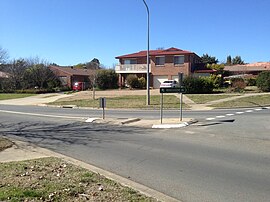
 Kosciusko Avenue | |||||||||||||||
| Coordinates | 35°11′40″S 149°06′50″E / 35.19457°S 149.11400°E | ||||||||||||||
| Population | 5,579 (SAL 2021)[1] | ||||||||||||||
| Established | 1994 | ||||||||||||||
| Postcode(s) | 2913 | ||||||||||||||
| Elevation | 622 m (2,041 ft) | ||||||||||||||
| Area | 1.9 km2 (0.7 sq mi) | ||||||||||||||
| Location |
| ||||||||||||||
| District | Gungahlin | ||||||||||||||
| Territory electorate(s) | Yerrabi | ||||||||||||||
| Federal division(s) | Fenner | ||||||||||||||
| |||||||||||||||
Palmerston (/ˈpɑːmərstən/) is a suburb in the Canberra, Australia district of Gungahlin. The postcode is 2913. The suburb is named after George Thomas Palmer (1784–1854) who established a settlement in the Canberra region in 1826 called Palmerville, which was later renamed Ginninderra. It was gazetted on 20 March 1991. Streets are named after mountains and mountain ranges of Australia, with the main street called Kosciuszko Avenue.[2] It is next to the suburbs of Nicholls, Gungahlin, Crace and Franklin. It was the second suburb to be developed in the Gungahlin district, after the industrial suburb of Mitchell. It is bounded by Gungahlin drive and Gundaroo drive.
- ^ Australian Bureau of Statistics (28 June 2022). "Palmerston (ACT) (suburb and locality)". Australian Census 2021 QuickStats. Retrieved 28 June 2022.
- ^ "Suburb Name search results". ACT Environment and Sustainable Development. Retrieved 10 February 2014.
