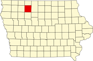
Palo Alto County | |
|---|---|
 | |
 Location within the U.S. state of Iowa | |
 Iowa's location within the U.S. | |
| Coordinates: 43°04′48″N 94°40′51″W / 43.08°N 94.680833333333°W | |
| Country | |
| State | |
| Founded | January 15, 1851 |
| Named for | Battle of Palo Alto |
| Seat | Emmetsburg |
| Largest city | Emmetsburg |
| Area | |
| • Total | 569 sq mi (1,470 km2) |
| • Land | 564 sq mi (1,460 km2) |
| • Water | 5.6 sq mi (15 km2) 1.0% |
| Population (2020) | |
| • Total | 8,996 |
| • Density | 16/sq mi (6.1/km2) |
| Time zone | UTC−6 (Central) |
| • Summer (DST) | UTC−5 (CDT) |
| Congressional district | 4th |
| Website | paloaltocounty |
Palo Alto County is a county located in the U.S. state of Iowa. As of the 2020 census, the population was 8,996.[1] The county seat is Emmetsburg.[2] It is named after the Battle of Palo Alto, the first major battle of the Mexican–American War.[3]
- ^ "2020 Census State Redistricting Data". census.gov. United states Census Bureau. Retrieved August 12, 2021.
- ^ "Find a County". National Association of Counties. Retrieved June 7, 2011.
- ^ McCarty, Dwight Gaylord (1910). History of Palo Alto County, Iowa. Torch Press. p. 63.