| Palos Forest Preserves | |
|---|---|
IUCN category V (protected landscape/seascape) | |
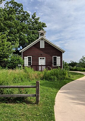
 Little Red Schoolhouse Nature Center | |
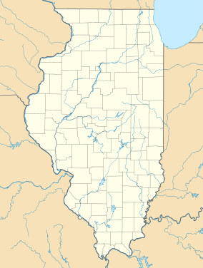
| Location | Cook County, Illinois |
| Nearest city | Palos Township, Cook County, IL |
| Coordinates | 41°42′28″N 87°52′25″W / 41.70778°N 87.87361°W |
| Area | 15,000 acres (61 km2) |
| Governing body | Forest Preserve District of Cook County |
The Palos Forest Preserves are 15,000 acres of forest preserves in the Forest Preserve District of Cook County, located principally in Palos Township, Illinois.[1]
During the 1930s, the area of the Palos Preserves south of Archer was known as the Argonne Forest. This commemorated the battleground of the Meuse–Argonne offensive where over one million Americans fought during World War I.[2] During World War II, Argonne Forest land leased to the Army Corps of Engineers became Site A, a research facility where experimental nuclear reactors built for the Manhattan Project helped in the development of the first nuclear weapons.
The Argonne Forest area is known to geologists as Mount Forest Island,[2] an area which, during the Last Glacial Period, formed a triangular island 6 miles (9.7 km) long and 4 miles (6.4 km) wide, rising 80 to 120 feet (24 to 37 m) above the waters of the surrounding ice-age Lake Chicago.[3]
The Palos Preserves feature the Palos Trail System, the forest district's largest multi-trail system.[4] The system comprises some 40 miles of unpaved trails, connected to each other by many intersections. The longest trail, "Yellow Unpaved" is 9.2 miles long, while "Brown Unpaved" is the shortest, at 1.1 miles. Trails are made for hiking, bicycle riding, horseback riding, and, in the winter, even skiing. There are sixteen entrances to the system which, along with the preserves as a whole, are open from dawn to dusk each day.[5]
The 6,600-acre Mount Forest Island area was, in 2021, designated an Urban Night Sky Place by the International Dark-Sky Association. It is the largest such Urban Night Sky Place designation in the world.[6][7]
Communities adjoining the preserves are Palos Hills, Palos Park, Hickory Hills, and Willow Springs.
- ^ "Have You Discovered the Palos Forest Preserves". Openlands.
- ^ a b Roberts Mann (1965). "Origin of names and histories of places: including major forests and holdings, picnic areas and recreational facilities, nature preserves, aquatic areas and wildlife refuges in the Forest Preserve District of Cook County, Illinois". Forest Preserve District of Cook County.
- ^ Alden, William C. (1902). "Description of the Chicago District". Geologic Atlas of the United States, Number 81. U.S. Geological Survey. Retrieved 2007-05-23. Epoch of glacial retreat:Chicago
- ^ "Palos Forest Preserve". Cambr.org.
- ^ "Forest Preserves of Cook County". FPDCC.
- ^ "Palos Preserves Named the World's Largest Urban Night Sky Place".
- ^ "Palos Preserves".

