You can help expand this article with text translated from the corresponding article in Spanish. (July 2013) Click [show] for important translation instructions.
|
Palos de la Frontera, Spain | |
|---|---|
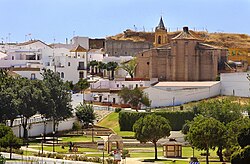
 Panoramic view of downtown Palos de la Frontera | |
 Location of Palos de la Frontera | |
| Coordinates: 37°13′42″N 6°53′40″W / 37.22833°N 6.89444°W | |
| Province | Huelva |
| Area | |
| • Total | 50 km2 (20 sq mi) |
| • Land | 50 km2 (20 sq mi) |
| • Water | 0.00 km2 (0.00 sq mi) |
| Population (2018)[1] | |
| • Total | 11,112 |
| • Density | 220/km2 (580/sq mi) |
| Demonym(s) | palermos (m.), palermas (f.) |
| Time zone | UTC+1 (CET) |
| • Summer (DST) | UTC+2 (CEST) |
| Website | www.palosfrontera.com |
Palos de la Frontera (Spanish pronunciation: [ˈpalos ðe la fɾonˈteɾa]) is a town and municipality located in the southwestern Spanish province of Huelva, in the autonomous community of Andalusia. It is situated some 13 km (8 mi) from the provincial capital, Huelva. According to the 2015 census, the city had a population of 10,365. It is most famous for being the place from which Columbus set sail in 1492, eventually reaching the Americas.
- ^ Municipal Register of Spain 2018. National Statistics Institute.

