This article needs additional citations for verification. (July 2016) |
Panskura | |
|---|---|
Town | |
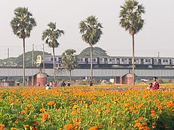
 Valley of Flowers in Panskura CD block | |
| Coordinates: 22°25′01″N 87°42′00″E / 22.417°N 87.700°E | |
| Country | India |
| State | West Bengal |
| District | Purba Medinipur |
| Government | |
| • Type | Municipality |
| • Body |
|
| Area | |
| • Total | 17.04 km2 (6.58 sq mi) |
| Elevation | 7 m (23 ft) |
| Population (2011) | |
| • Total | 57,932 |
| • Density | 3,400/km2 (8,800/sq mi) |
| Languages | |
| • Official | English, Bengali |
| Time zone | UTC+5:30 (IST) |
| Pin code | 721139 |
| Lok Sabha constituency | Ghatal |
| Vidhan Sabha constituency | Panskura Paschim |
| Avg. summer temperature | 38 °C (100 °F) |
| Avg. winter temperature | 9 °C (48 °F) |
| Website | panskuramunicipality |
Panskura is a town and municipality in Purba Medinipur district in the Indian state of West Bengal. It is situated on the banks of the Kangsabati River (variously known as Kasai and Cossye).

