Papagou
Παπάγου | |
|---|---|
 | |
| Coordinates: 37°59.4′N 23°47.6′E / 37.9900°N 23.7933°E | |
| Country | Greece |
| Administrative region | Attica |
| Regional unit | North Athens |
| Municipality | Papagou-Cholargos |
| Area | |
| • Municipal unit | 3.375 km2 (1.303 sq mi) |
| Elevation | 200 m (700 ft) |
| Population (2021)[1] | |
| • Municipal unit | 13,962 |
| • Municipal unit density | 4,100/km2 (11,000/sq mi) |
| Time zone | UTC+2 (EET) |
| • Summer (DST) | UTC+3 (EEST) |
| Postal code | 156 69 |
| Area code(s) | 210 65 |
| Vehicle registration | I, Y, Z |
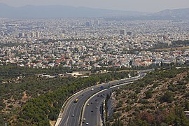
Papagou (Greek: Παπάγου or Παπάγος Papagos) is a suburban town and municipal unit in the eastern part of the Athens agglomeration, Greece. The town is named after Marshal Alexandros Papagos, a general who led the Greek Army in the Second World War and the Greek Civil War, before becoming Prime Minister of Greece. The Greek Ministry of National Defense is located in town.
Papagou was part of the municipality of Cholargos until 1965, when it became a separate community. It became a municipality in 1982.[2] Since the 2011 local government reform it is part of the municipality Papagou-Cholargos, of which it is a municipal unit according to the Kallikratis Plan.[3]
- ^ "Αποτελέσματα Απογραφής Πληθυσμού - Κατοικιών 2021, Μόνιμος Πληθυσμός κατά οικισμό" [Results of the 2021 Population - Housing Census, Permanent population by settlement] (in Greek). Hellenic Statistical Authority. 29 March 2024.
- ^ "EETAA local government changes". Retrieved 28 June 2020.
- ^ "ΦΕΚ B 1292/2010, Kallikratis reform municipalities" (in Greek). Government Gazette.

