Pares | |
|---|---|
Village | |
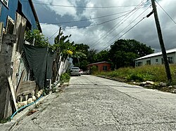
 Pares East #1 neighbourhood in 2023 | |
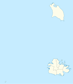
| Coordinates: 17°05′N 61°45′W / 17.083°N 61.750°W | |
| Country | Antigua and Barbuda |
| Island | Antigua |
| Civil parish | Saint Peter |
| Major division | Pares |
| Established | 1750 |
| Founded by | John Pare |
| Government | |
| • MP | Vacant |
| Area | |
• Total | 0.56 km2 (0.22 sq mi) |
| Population (2011) | |
• Total | 575 |
| • Density | 1,026.8/km2 (2,659/sq mi) |
| Time zone | UTC-4 (AST) |
This article's lead section may be too short to adequately summarize the key points. (November 2023) |
Pares is a small village in central Antigua. it is located to the north of Potworks Dam and south of the town of Parham on the road between Freemans and Willikies.
