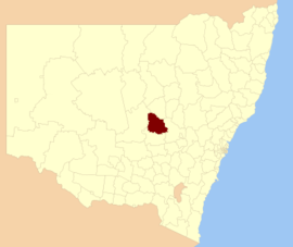
| Parkes Shire New South Wales | |||||||||||||||
|---|---|---|---|---|---|---|---|---|---|---|---|---|---|---|---|
 Location in New South Wales | |||||||||||||||
| Coordinates | 33°08′S 148°10′E / 33.133°S 148.167°E | ||||||||||||||
| Population | 14,361 (2021 census)[1] | ||||||||||||||
| • Density | 2.41037/km2 (6.2428/sq mi) | ||||||||||||||
| Established | 1981 | ||||||||||||||
| Area | 5,958 km2 (2,300.4 sq mi) | ||||||||||||||
| Mayor | Neil Westcott (Unaligned) | ||||||||||||||
| Council seat | Parkes[2] | ||||||||||||||
| Region | Central West | ||||||||||||||
| State electorate(s) | Orange | ||||||||||||||
| Federal division(s) | Calare | ||||||||||||||
 | |||||||||||||||
| Website | Parkes Shire | ||||||||||||||
| |||||||||||||||
Parkes Shire is a local government area in the Central West region of New South Wales, Australia. The Shire is located adjacent to the Broken Hill railway line and the Newell Highway.
The area under administration includes the town of Parkes and the surrounding region of 5,919 square kilometres (2,285 sq mi), with a population of approximately 14,592 as of 2011. The Shire includes the towns of Peak Hill, Alectown, Bogan Gate, Trundle and Tullamore.
The mayor of Parkes Shire Council is Cr. Neil Westcott, who is unaligned with any political party.
- ^ Australian Bureau of Statistics (28 June 2022). "Parkes (A)". 2021 Census QuickStats. Retrieved 27 November 2017.
- ^ "Parkes Shire Council". Division of Local Government. Retrieved 28 November 2006.