| Paropamisus Mountains | |
|---|---|
 | |
| Highest point | |
| Elevation | 3,592 m (11,785 ft) |
| Coordinates | 34°28′01″N 63°1′51″E / 34.46694°N 63.03083°E |
| Geography | |
| Location | Northwestern Afghanistan |


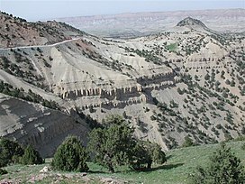
The Paropamisus Mountains[2] (locally known as Selseleh-ye Safīd Kūh[3]) is a mountain range in north western Afghanistan stretching circa 300 mi (480 km)[4] between the western extension of the Hindu Kush in the east (near Chaghcharan, also called Firozkoh) and following the north bank of the Hari River via Herat toward the eastern extensions of Alborz Mountains in Iran in the west. These mountains are part of the large Alpide belt.
Silver and lead deposits are found in Paropamisus. The Marghab River rise is in the region.[4]
- ^ 11,785 ft in topographic map of northern Afghanistan, 1982
- ^ Physical map of Afghanistan, on www.ezilon.com
- ^ "Herāt". in: Encyclopedia Britannica, 29 Jun. 2021, Accessed 6 January 2022, ATTENTION: The name there is right but the link in the article is wrong and leading to the other ″Selseleh-ye Safīd Kūh″ Spīn Ghar.
- ^ a b Paropamisus in: The Columbia Encyclopedia, 6th ed., 28 Dec. 2021
