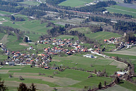
Paspels | |
|---|---|
 | |
| Coordinates: 46°44′N 9°26′E / 46.733°N 9.433°E | |
| Country | Switzerland |
| Canton | Graubünden |
| District | Hinterrhein |
| Area | |
| • Total | 4.59 km2 (1.77 sq mi) |
| Elevation | 778 m (2,552 ft) |
| Population (Dec 2013) | |
| • Total | 475 |
| • Density | 100/km2 (270/sq mi) |
| Time zone | UTC+01:00 (Central European Time) |
| • Summer (DST) | UTC+02:00 (Central European Summer Time) |
| Postal code(s) | 7417 |
| SFOS number | 3634 |
| ISO 3166 code | CH-GR |
| Surrounded by | Almens, Cazis, Rodels, Trans, Tumegl/Tomils |
| Website | www SFSO statistics |
Paspels (Romansh: Pasqual) is a former municipality in the district of Hinterrhein in the Swiss canton of Graubünden. On 1 January 2015 the former municipalities of Almens, Paspels, Pratval, Rodels and Tomils merged to form the new municipality of Domleschg.[1]
- ^ Amtliches Gemeindeverzeichnis der Schweiz published by the Swiss Federal Statistical Office (in German) accessed 2 January 2013


