| Paw Paw River | |
|---|---|
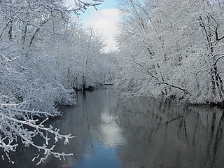
 The Paw Paw River after a snowfall in Van Buren County, Michigan | |
 | |
| Location | |
| Country | United States |
| State | Michigan |
| Counties | Van Buren, Berrien |
| Physical characteristics | |
| Source | Confluence of North Branch Paw Paw River and South Branch Paw Paw River |
| • location | North of Paw Paw |
| • coordinates | 42°15′52″N 085°55′35″W / 42.26444°N 85.92639°W |
| • elevation | 686 ft (209 m) |
| Mouth | St. Joseph River |
• location | Benton Harbor |
• coordinates | 42°06′45″N 086°28′15″W / 42.11250°N 86.47083°W[1] |
• elevation | 581 ft (177 m)[1] |
| Length | 61.8 miles (99.5 km) |
| Basin features | |
| Tributaries | |
| • left | South Branch Paw Paw River, Carter Creek, Brush Creek, Hog Creek, Pine Creek, Mill Creek, Ryno Drain, Blue Creek, Sand Creek, Ox Creek |
| • right | North Branch Paw Paw River, Butterfield Drain, Mud Lake Drain, Paw Paw Lake, Granger Drain |
The Paw Paw River is located in the U.S. state of Michigan in the southwest portion of the lower peninsula. It is formed by the confluence of the north and south branches at 42°15′17″N 85°55′36″W / 42.25472°N 85.92667°W[1][2][3] in Waverly Township in the northeast of Van Buren County. It flows approximately 61.8 miles (99.5 km)[4] through Van Buren County and Berrien County until joining the St. Joseph River just above its mouth on Lake Michigan at Benton Harbor.
- ^ a b c U.S. Geological Survey Geographic Names Information System: Paw Paw River
- ^ U.S. Geological Survey Geographic Names Information System: North Branch Paw Paw River
- ^ U.S. Geological Survey Geographic Names Information System: South Branch Paw Paw River
- ^ U.S. Geological Survey. National Hydrography Dataset high-resolution flowline data. The National Map, accessed May 19, 2011