| Pawcatuck River | |
|---|---|
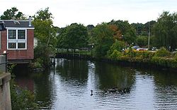
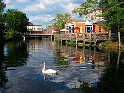
 The Pawcatuck River as it flows between Westerly, Rhode Island, and Pawcatuck, Connecticut | |
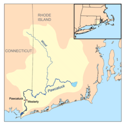
 Pawcatuck River watershed | |
| Location | |
| Country | United States |
| State | Connecticut / Rhode Island |
| County | New London County, Connecticut Washington County, Rhode Island |
| Physical characteristics | |
| Source | Worden Pond |
| • location | South Kingstown, Rhode Island |
| • coordinates | 41°26′32″N 71°35′27″W / 41.4423°N 71.5909°W |
| Mouth | Little Narragansett Bay, Long Island Sound |
• location | Pawcatuck, Connecticut / Westerly, Rhode Island |
• coordinates | 41°19′N 71°52′W / 41.32°N 71.86°W |
| Designated | March 12, 2019[1] |

The Pawcatuck River is a river in the US states of Rhode Island and Connecticut flowing approximately 34 miles (55 km).[2] There are eight dams along the river's length.[3] USS Pawcatuck was named after the river.
- ^ "Explore Designated Rivers". Rivers.gov. Retrieved January 8, 2022.
- ^ U.S. Geological Survey. National Hydrography Dataset high-resolution flowline data. The National Map, accessed April 1, 2011
- ^ Governor's Task Force on Dam Safety and Maintenance – Final Report, January 2001