| Peaslake | |
|---|---|
| Village | |
 Part of the village centre | |
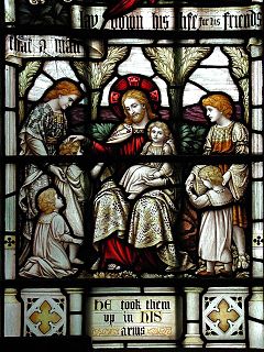
 St Mark's Church, Peaslake, detail. | |
Location within Surrey | |
| Population | 878 [1] |
| OS grid reference | TQ085447 |
| Civil parish | |
| District | |
| Shire county | |
| Region | |
| Country | England |
| Sovereign state | United Kingdom |
| Post town | Guildford |
| Postcode district | GU5 |
| Dialling code | 01306 |
| Police | Surrey |
| Fire | Surrey |
| Ambulance | South East Coast |
| UK Parliament | |
Peaslake, Hoe, and Colman's Hill are in the centre of the Surrey Hills National Landscape and mid-west of the Greensand Ridge about 5 miles (8.0 km) ESE of Guildford. Surrounded by denser pine and other coniferous forest-clad hills, the three conjoined settlements have a small core in Peaslake itself with the amenities of a village, but are otherwise lightly scattered settlements at a higher elevation than the centre of Shere, the civil parish.
The area referred to by the 2011 census covers 302 hectares (750 acres). Friends of the Hurtwood maintains and coppices 3,000 acres (1,200 ha) of surrounding forest, the Hurtwood, which comprises: Holmbury Hill, Pitch Hill, Winterfold, Shere Heath, Farley Heath and part of Blackheath Common. It is in the civil parish of Shere.
- ^ Key Statistics; Quick Statistics: Population Density United Kingdom Census 2011 Office for National Statistics Retrieved 6 November 2013
