Pedro Aguirre Cerda | |
|---|---|
 PAC at the left of the highway in 2007 | |
|
| |
| Coordinates (city): 33°29.5′S 70°40.5′W / 33.4917°S 70.6750°W | |
| Country | Chile |
| Region | Santiago Metro. |
| Province | Santiago |
| Government | |
| • Type | Municipality |
| • Alcalde | Juan Rozas Romero (Independent pro-PPD) |
| Area | |
• Total | 9.7 km2 (3.7 sq mi) |
| Population (2002 Census)[3] | |
• Total | 114,560 |
| • Density | 12,000/km2 (31,000/sq mi) |
| • Urban | 114,560 |
| • Rural | 0 |
| Sex | |
| • Men | 55,382 |
| • Women | 59,178 |
| Time zone | UTC-4 (CLT[4]) |
| • Summer (DST) | UTC-3 (CLST[5]) |
| Area code | 56 + |
| Website | Municipality of Pedro Aguirre Cerda |
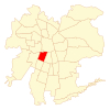
Pedro Aguirre Cerda (Spanish pronunciation: [ˈpeðɾo aˈɣire ˈseɾða]) is a commune of Chile located in Santiago Province, Santiago Metropolitan Region. It is named after President Pedro Aguirre Cerda.
- ^ "Asociación Chilena de Municipalidades" (in Spanish). Retrieved 27 January 2011.
- ^ "Municipality of Pedro Aguirre Cerda" (in Spanish). Retrieved 27 January 2011.
- ^ a b c "National Statistics Institute" (in Spanish). Retrieved 13 December 2010.
- ^ "Chile Time". WorldTimeZones.org. Archived from the original on September 11, 2007. Retrieved 26 September 2010.
- ^ "Chile Summer Time". WorldTimeZones.org. Archived from the original on September 11, 2007. Retrieved 26 September 2010.


