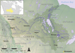
| Pepaw River Peepaw River | |
|---|---|
 Nelson River drainage basin | |
| Location | |
| Country | |
| Provinces | |
| Rural municipality | RM of Hudson Bay No. 394 |
| Physical characteristics | |
| Source | |
| • location | Porcupine Hills |
| • coordinates | 52°21′25″N 102°31′04″W / 52.3570°N 102.5177°W |
| • elevation | 599 m (1,965 ft) |
| Mouth | Etomami River |
• coordinates | 52°40′23″N 102°22′23″W / 52.6730°N 102.3730°W |
• elevation | 386 m (1,266 ft) |
| Basin features | |
| River system | Red Deer River |
Pepaw River,[1] also spelt Peepaw, is a river in the east-central part of the Canadian province of Saskatchewan in the boreal forest[2] ecozone of Canada. It begins in the Porcupine Hills and flows northward and meets up with the Etomami River south of the town of Hudson Bay. Much of the river is within Saskatchewan's Porcupine Provincial Forest and as such has various recreational opportunities along its course.[3]
Pepaw River and its amenities are accessed from three different highways. The part of the river that runs west to east past McBride Lake is paralleled by Highway 983 and the north flowing leg at the lower end of the river is paralleled by Highway 982, also known as Little Swan Road. Highway 9 crosses the river near its mouth.
- ^ Government of Canada, Natural Resources Canada. "Place names - Pepaw River". www4.rncan.gc.ca. Archived from the original on 12 April 2022. Retrieved 10 April 2022.
- ^ "Boreal Plains Ecozone". ecozones. Archived from the original on 19 April 2021. Retrieved 10 April 2022.
- ^ "Pepaw River". Geoview.info. Archived from the original on 12 April 2022. Retrieved 10 April 2022.

