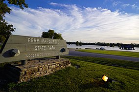
| Pere Marquette State Park | |
|---|---|
 | |
Map of the U.S. state of Illinois showing the location of Pere Marquette State Park | |
| Location | Jersey County, Illinois, USA |
| Nearest city | Grafton, Illinois |
| Coordinates | 38°59′57″N 90°31′33″W / 38.99917°N 90.52583°W |
| Area | 8,050 acres (3,260 ha) |
| Established | 1931 |
| Governing body | Illinois Department of Natural Resources |
Pere Marquette State Park Lodge and Cabins | |
| Location | Box 158, Grafton, Illinois |
| Area | 16 acres (6.5 ha) |
| Architect | Booten, Joseph F. |
| MPS | Illinois State Parks Lodges and Cabins TR |
| NRHP reference No. | 85002405[1] |
| Added to NRHP | March 4, 1985 |
Pere Marquette State Park is an 8,050-acre (3,260 ha) protected area in southwestern Jersey County, Illinois, United States.[2] It is located near the city of Grafton, Illinois, at the confluence of the Mississippi River and the Illinois River. The park is located on Illinois Route 100, which at this location is also part of both the Great River Road and the Meeting of the Great Rivers Scenic Byway. The park is operated and maintained by the Illinois Department of Natural Resources. The park is also part of the Confluence Greenway and is at the northwestern end of the 21.5-mile (34.6 km) Sam Vadalabene Bike Trail.
- ^ "National Register Information System". National Register of Historic Places. National Park Service. July 9, 2010.
- ^ "Pere Marquette State Park". Illinois Department of Natural Resources. Archived from the original on April 21, 2007. Retrieved July 19, 2018.

