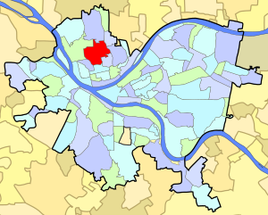
Perry South
Perry Hilltop | |
|---|---|
 Along Perrysville Avenue in Perry South | |
 | |
| Coordinates: 40°28′05″N 80°00′54″W / 40.468°N 80.015°W | |
| Country | United States |
| State | Pennsylvania |
| County | Allegheny County |
| City | Pittsburgh |
| Area | |
| • Total | 0.905 sq mi (2.34 km2) |
| Population (2010)[1] | |
| • Total | 4,145 |
| • Density | 4,600/sq mi (1,800/km2) |
Perry South—also known as Perry Hilltop—is a neighborhood on Pittsburgh, Pennsylvania's North Side. It developed as a streetcar suburb around the turn of the 20th century, so it consists almost exclusively of residential housing, with a small business district at the intersection of Perrysville Avenue and Charles Avenue. The hill on which the neighborhood is built provides natural borders to the west (the Charles Street Valley), to the east (Parkway North) and to the south (the Mexican War Streets).
Perry South has representation on Pittsburgh City Council by the council member for District 6. It is within Pittsburgh's 26th ward.
The section of Perry South surrounding Charles Street was once called Pleasant Valley and considered a neighborhood in its own right.[2] The area is now known as the Charles Street Valley.
- ^ a b "PGHSNAP 2010 Raw Census Data by Neighborhood". Pittsburgh Department of City Planning. 2012. Retrieved 28 June 2013.
- ^ Cite error: The named reference
1977 pvwas invoked but never defined (see the help page).