Peyton, Colorado | |
|---|---|
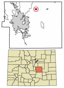
 Location of the Peyton CDP in El Paso County, Colorado | |
| Coordinates: 39°01′59″N 104°29′25″W / 39.03306°N 104.49028°W[1] | |
| Country | |
| State | |
| County | El Paso County |
| Government | |
| • Type | unincorporated community |
| Area | |
• Total | 5.950 km2 (2.297 sq mi) |
| • Land | 5.950 km2 (2.297 sq mi) |
| • Water | 0.000 km2 (0.000 sq mi) |
| Elevation | 2,096 m (6,877 ft) |
| Population | |
• Total | 214 |
| • Density | 36/km2 (93/sq mi) |
| Time zone | UTC-7 (MST) |
| • Summer (DST) | UTC-6 (MDT) |
| ZIP Code[4] | 80831 |
| Area code | 719 |
| GNIS feature ID | 2583278[1] |
Peyton is an unincorporated town, a post office, and a census-designated place (CDP) located in and governed by El Paso County, Colorado, United States. The CDP is a part of the Colorado Springs, CO Metropolitan Statistical Area. The Peyton post office has the ZIP Code 80831.[4] At the United States Census 2020, the population of the Peyton CDP was 214.[3]
The nearby unincorporated area of Falcon also uses zip code 80831.[4] Peyton and towns such as Falcon, Calhan, Ramah, Simla, and Matheson straddle U.S. Highway 24 between Colorado Springs and Limon, Colorado where US 24 intersects with Interstate 70.
- ^ a b c d U.S. Geological Survey Geographic Names Information System: Peyton, Colorado
- ^ "State of Colorado Census Designated Places - BAS20 - Data as of January 1, 2020". United States Census Bureau. Retrieved December 22, 2020.
- ^ a b United States Census Bureau. "Peyton CDP, Colorado". Retrieved April 16, 2023.
- ^ a b c "Look Up a ZIP Code". United States Postal Service. Retrieved December 22, 2020.
