| Phawngpui | |
|---|---|
| Phunpi Klang | |
 Phawngpui Farpak | |
| Highest point | |
| Elevation | 2,157 m (7,077 ft) |
| Listing | List of Indian states and territories by highest point |
| Coordinates | 22°37′53.4″N 93°02′19.68″E / 22.631500°N 93.0388000°E[1] |
| Geography | |
near the Myanmar border in Lawngtlai District | |
| Parent range | Mizoram, India |
| Topo map | "NF 46-7, Gangaw, Burma"[2] |
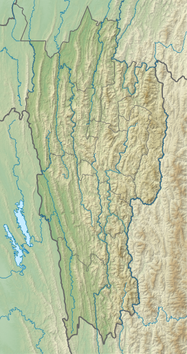
Phawngpui (Pron: /ˌpʰɔ:ŋˈpʊɪ/), also known as Blue Mountain, is the highest mountain peak in the Mizo Hills (Lushai Hills) and in the state of Mizoram, India,[3] with an elevation of 2157 m.[4] It is in Lawngtlai district, in the southeastern region of Mizoram near the Myanmar border.
- ^ Phunpi Klang (Approved - N) at GEOnet Names Server, United States National Geospatial-Intelligence Agency
- ^ "NF 46-7, Gangaw, Burma" topographic map, Series U542, U.S. Army Map Service, April 1958, listed as Blue Mountain
- ^ "Phawngpui". MizoTourism. Archived from the original on 3 March 2013.
- ^ Pachuau, Rintluanga (2009). Mizoram: A Study in Comprehensive Geography. Northern Book Center. p. 30. ISBN 8172112645.

