| Phayao Lake | |
|---|---|
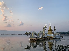
 Sunset at Phayao Lake, 2021 | |
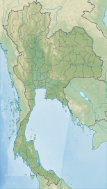
| Location | Phayao Province, Thailand |
| Coordinates | 19°10′N 99°52′E / 19.167°N 99.867°E |
| Primary inflows | Ing River, Tam River |
| Primary outflows | Ing River |
| Basin countries | Thailand |
| Surface area | 1,980 hectares (19.8 km2) |
| Average depth | 1.5 metres (4 ft 11 in) |
| Max. depth | 4 metres (13 ft) |
| Shore length1 | 25.16 kilometres (15.63 mi) |
| Surface elevation | 393 metres (1,289 ft) |
| Settlements | Phayao |
| 1 Shore length is not a well-defined measure. | |
Kwan Phayao (Thai: กว๊านพะเยา, RTGS: Kwan Phayao, pronounced [kwáːn pʰā.jāw]) is a lake in Phayao Province, northern Thailand. Kwan,[1] a word from the northern Thai language, means 'lake' or 'large swamp'. The shape of the lake is a nearly-half-circle-moon shape. Phayao Lake is the largest freshwater lake in the northern region and the fourth largest in the country, with a depth of 1.5 metres,[2] and covers an area of about 1,980 hectares.[3][4] There are about 50 species of fish in Phayao Lake.
- ^ Cite error: The named reference
refname1was invoked but never defined (see the help page). - ^ Cite error: The named reference
refname2was invoked but never defined (see the help page). - ^ Cite error: The named reference
refname3was invoked but never defined (see the help page). - ^ Cite error: The named reference
refname4was invoked but never defined (see the help page).
