| Pheasant Creek Victoria | |||||||||||||||
|---|---|---|---|---|---|---|---|---|---|---|---|---|---|---|---|
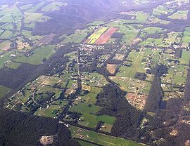
 view from north | |||||||||||||||
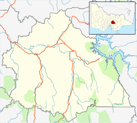
| Coordinates | 37°29′S 145°17′E / 37.483°S 145.283°E | ||||||||||||||
| Population | 360 (2021 census)[1] | ||||||||||||||
| Postcode(s) | 3757 | ||||||||||||||
| Location | 59 km (37 mi) N of Melbourne | ||||||||||||||
| LGA(s) | Shire of Murrindindi | ||||||||||||||
| State electorate(s) | Eildon | ||||||||||||||
| Federal division(s) | Indi | ||||||||||||||
| |||||||||||||||
Pheasant Creek is a locality in Victoria to the east of Kinglake West and to the west of Kinglake Central. Named after the creek that passes through the north of the town, Pheasant Creek is a largely residential area with moderately sized bush blocks connecting pine plantations to the north with the Kinglake National Park to the south. Pheasant Creek also contains a small industrial estate hosting a variety of small businesses, and a small commercial area consisting of a General Store, Bakery and Gym.
- ^ Australian Bureau of Statistics (28 June 2022). "Pheasant Creek (Vic.) (Suburb and Locality)". 2021 Census QuickStats. Retrieved 16 July 2024.
