Philip S. W. Goldson International Airport | |||||||||||
|---|---|---|---|---|---|---|---|---|---|---|---|
 | |||||||||||
| Summary | |||||||||||
| Airport type | Public | ||||||||||
| Serves | Belize City | ||||||||||
| Location | Ladyville | ||||||||||
| Hub for | |||||||||||
| Elevation AMSL | 5 m / 16 ft | ||||||||||
| Coordinates | 17°32′21″N 088°18′30″W / 17.53917°N 88.30833°W | ||||||||||
| Website | pgiabelize.com | ||||||||||
| Map | |||||||||||
 | |||||||||||
| Runways | |||||||||||
| |||||||||||
| Statistics (2023) | |||||||||||
| |||||||||||
Source: Passenger and aircraft movement statistics from PGIA airport[1] | |||||||||||
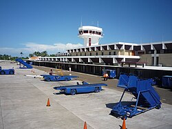
Philip S. W. Goldson International Airport (IATA: BZE, ICAO: MZBZ) is an airport that serves the nation of Belize's largest city, Belize City along the eastern coast of Central America. It was named after politician Philip S. W. Goldson, who died in 2001. The airport is at an elevation of 5 m (16 ft), which means both the airport and the entirety of Belize City are at risk of serious flooding due to its low elevation and coastal location. For this reason, Belize's capital has been moved to Belmopan, but the airport remains the largest and busiest in the country. With stable passenger growth, Philip S. W. Goldson International Airport is currently the fifth busiest airport in Central America. Belize Airport covers 457 acres (185 ha) of land and has one runway.[2]
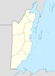
The airport is about 30 minutes drive from Belize City's centre, in Ladyville. In mid-2020, a new paved access road was completed from the George Price Highway, eight kilometres north, across the Belize River, directly to the side of the airfield where the passenger terminal is located.
- ^ "Philip S.W. Goldson International Airport - About us". Belize Airport Concession Company Limited. Retrieved 9 March 2024.
- ^ "Belize Airport Facts and Figures". pgiabelize.com. Retrieved 20 October 2023.
