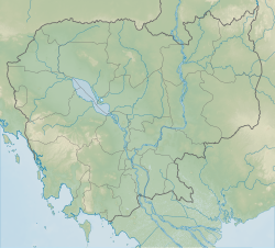
| Phnom Dei | |
|---|---|
 View of Phnom Dei | |
| Highest point | |
| Elevation | 272 m (892 ft) |
| Coordinates | 13°35′45″N 103°59′1″E / 13.59583°N 103.98361°E[1] |
| Naming | |
| Native name | ភ្នំដី |
| Geography | |
| Location | Siem Reap Province, Cambodia |
| Geology | |
| Mountain type | Sandstone |
| Climbing | |
| Easiest route | Drive to Banteay Srei, then hike |
Phnom Dei (Khmer: ភ្នំដី [pʰnom ɗəj]) is a 272 m high hill close to Siem Reap, Cambodia.
