| Phnom Kulen National Park | |
|---|---|
| Jayavarman-Norodom Phnom Kulen National Park | |
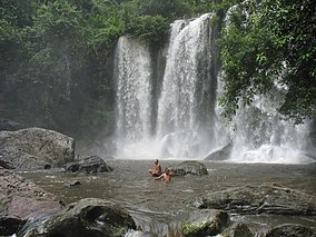
 Waterfall in Phnom Kulen National Park | |
| Location | Svay Leu District, Siem Reap Province, Cambodia |
| Nearest city | Siem Reap |
| Coordinates | 13°36′22″N 104°05′45″E / 13.6062°N 104.0957°E |
| Area | 373.76 km2 (144.31 sq mi) |
| Established | 1993[1] |
The Phnom Kulen National Park (Khmer: ឧទ្យានជាតិភ្នំគូលែន) is a national park in Cambodia, located in the Phnom Kulen mountain massif in Siem Reap Province. It was established in 1993 and covers 373.76 km2 (144.31 sq mi). Its official name is Jayavarman-Norodom Phnom Kulen National Park (Khmer: ឧទ្យានជាតិព្រះជ័យវរ្ម័ន-នរោត្តម ភ្នំគូលែន).
During the Khmer Empire the area was known as Mahendraparvata (the mountain of Great Indra) and was the place where King Jayavarman II had himself declared chakravartin (King of Kings), an act which is considered the foundation of the empire.[2]
- ^ a b Protected Planet (2018). "Phnom Kulen National Park". United Nations Environment World Conservation Monitoring Centre. Retrieved 26 Dec 2018.
- ^ Higham, 2001: pp. 54–59
