Pho Thong
โพธิ์ทอง | |
|---|---|
Reclining Buddha of Wat Khun Inthapramun | |
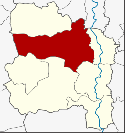
 District location in Ang Thong province | |
| Coordinates: 14°40′1″N 100°24′29″E / 14.66694°N 100.40806°E | |
| Country | Thailand |
| Province | Ang Thong |
| Area | |
• Total | 219.4 km2 (84.7 sq mi) |
| Population (2000) | |
• Total | 53,135 |
| • Density | 240/km2 (630/sq mi) |
| Time zone | UTC+7 (ICT) |
| Postal code | 14120 |
| Geocode | 1504 |
Pho Thong (Thai: โพธิ์ทอง, pronounced [pʰōː tʰɔ̄ːŋ]) is a district (amphoe) in the northern part of Ang Thong province, central Thailand.

