| Phosphoria Formation | |
|---|---|
Stratigraphic range: | |
 | |
| Type | Geological formation |
| Underlies | Dinwoody Formation |
| Overlies | Casper Formation, Park City Formation, Tensleep Sandstone |
| Area | 350,000 sq. km (140,000 sq. mi)[1] |
| Thickness | Up to 420 metres (1,380 ft)[1] |
| Lithology | |
| Primary | Limestone, dolomite, shale |
| Other | Chert, phosphorite, sandstone |
| Location | |
| Region | Idaho, Montana, Utah, Wyoming[2] |
| Country | |
| Type section | |
| Named for | Phosphoria Gulch, Idaho |
| Named by | Richards and Mansfield, 1912[3] |

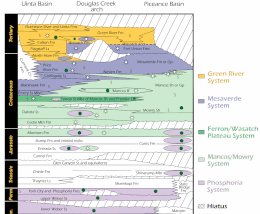
The Phosphoria Formation of the western United States is a geological formation of Early Permian age.[4] It represents some 15 million years of sedimentation, reaches a thickness of 420 metres (1,380 ft) and covers an area of 350,000 square kilometres (140,000 sq mi).[1]
The Phosphoria includes phosphorite beds that are an important source of phosphorus.[5] Many of its shales are rich in organic matter and are petroleum source rocks,[6] and some of its dolomites include petroleum reservoirs.[7]
- ^ a b c Blatt, Harvey and Robert J. Tracy, Petrology, Freeman, 1996, 2nd ed. pp. 345-349 ISBN 0-7167-2438-3
- ^ Cite error: The named reference
USGSwas invoked but never defined (see the help page). - ^ Richards, R.W., and Mansfield, G.R., 1912, The Bannock overthrust; a major fault in southeastern Idaho and northeastern Utah: Journal of Geology, v. 20, no. 8, p. 681-709.
- ^ Behnken, F.H., Wardlaw, B.R. and Stout, L.N., 1986, Conodont biostratigraphy of the Permian Meade Peak Phosphatic Shale Member, Phosphoria Formation, southeastern Idaho. University of Wyoming Contributions to Geology, v. 24, no. 2, p. 169-190.
- ^ Cite error: The named reference
McKelveywas invoked but never defined (see the help page). - ^ Cite error: The named reference
Maughanwas invoked but never defined (see the help page). - ^ Cite error: The named reference
Campbellwas invoked but never defined (see the help page).