This article has an unclear citation style. (June 2019) |

Photogrammetry is the science and technology of obtaining reliable information about physical objects and the environment through the process of recording, measuring and interpreting photographic images and patterns of electromagnetic radiant imagery and other phenomena.[1]

While the invention of the method is attributed to Aimé Laussedat,[2] the term "photogrammetry" was coined by the German architect Albrecht Meydenbauer,[3] which appeared in his 1867 article "Die Photometrographie."[4]

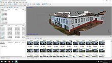
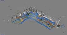
There are many variants of photogrammetry. One example is the extraction of three-dimensional measurements from two-dimensional data (i.e. images); for example, the distance between two points that lie on a plane parallel to the photographic image plane can be determined by measuring their distance on the image, if the scale of the image is known. Another is the extraction of accurate color ranges and values representing such quantities as albedo, specular reflection, metallicity, or ambient occlusion from photographs of materials for the purposes of physically based rendering.
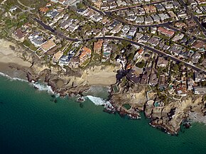
Close-range photogrammetry refers to the collection of photography from a lesser distance than traditional aerial (or orbital) photogrammetry. Photogrammetric analysis may be applied to one photograph, or may use high-speed photography and remote sensing to detect, measure and record complex 2D and 3D motion fields by feeding measurements and imagery analysis into computational models in an attempt to successively estimate, with increasing accuracy, the actual, 3D relative motions.
From its beginning with the stereoplotters used to plot contour lines on topographic maps, it now has a very wide range of uses such as sonar, radar, and lidar.
- ^ ASPRS online Archived May 20, 2015, at the Wayback Machine
- ^ "Photogrammetry history and modern uses". 8 June 2022.
- ^ "Photogrammetry and Remote Sensing" (PDF). Archived from the original (PDF) on 2017-08-30.
- ^ Albrecht Meydenbauer: Die Photometrographie. In: Wochenblatt des Architektenvereins zu Berlin Jg. 1, 1867, Nr. 14, S. 125–126 (Digitalisat); Nr. 15, S. 139–140 (Digitalisat); Nr. 16, S. 149–150 (Digitalisat).