Phu Cat Airport Sân bay Phù Cát | |||||||||||
|---|---|---|---|---|---|---|---|---|---|---|---|
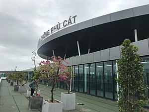
 Terminal entrance | |||||||||||
| Summary | |||||||||||
| Airport type | Public / military | ||||||||||
| Operator | Middle Airport Authority | ||||||||||
| Serves | Quy Nhơn | ||||||||||
| Location | Phù Cát | ||||||||||
| Operating base for | Bamboo Airways | ||||||||||
| Elevation AMSL | 24 m / 79 ft | ||||||||||
| Coordinates | 13°57′18″N 109°02′32″E / 13.95500°N 109.04222°E | ||||||||||
| Website | www | ||||||||||
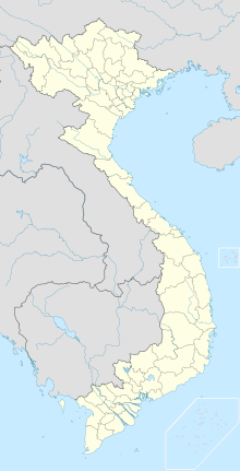
| Map | |||||||||||
 | |||||||||||
| Runways | |||||||||||
| |||||||||||
| Statistics (2015) | |||||||||||
| |||||||||||
Phu Cat Airport (IATA: UIH, ICAO: VVPC) is an airport serving Quy Nhơn, Vietnam. It is in Phù Cát district between the towns of Ngo May and Đập Đá, around 30 kilometres (19 mi) northwest of Qui Nhơn within Bình Định province along the South Central Coast of Vietnam.
As well as being a commercial airport, Phu Cat is also used by the Vietnam People's Air Force, being home to the nation's sole squadrons of Sukhoi Su-27 and Yakovlev Yak-130.
Phu Cat Airport is the registered hub serving Bamboo Airways. Phu Cat Airport handled 1.5 million passengers in 2017.[4]
- ^ a b Trí Dũng. "Bình Định đề xuất xây Nhà ga hành khách sân bay Phù Cát". Thời báo Tài chính Việt Nam. Retrieved 2 September 2018.
- ^ Airport information for VVPC at Great Circle Mapper.
- ^ Airport information for Phu Cat Airport at Transport Search website.
- ^ "Chỉ bù lỗ sân bay ít khách" (in Vietnamese). Nguoi lao dong. 30 November 2017. Retrieved 2019-05-10.
