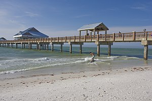
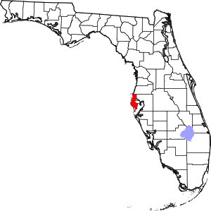
Pinellas County | |
|---|---|
 | |
 Location within the U.S. state of Florida | |
 Florida's location within the U.S. | |
| Coordinates: 27°54′N 82°44′W / 27.90°N 82.74°W | |
| Country | |
| State | |
| Founded | January 1, 1912 |
| Named for | Spanish Punta Piñal ("Point of Pines") |
| Seat | Clearwater |
| Largest city | St. Petersburg |
| Area | |
• Total | 608 sq mi (1,570 km2) |
| • Land | 274 sq mi (710 km2) |
| • Water | 334 sq mi (870 km2) 55.0% |
| Population (2020) | |
• Total | 959,107 |
• Estimate (2023) | |
| • Density | 3,491/sq mi (1,348/km2) |
| Time zone | UTC−5 (Eastern) |
| • Summer (DST) | UTC−4 (EDT) |
| Congressional districts | 13th, 14th |
| Website | www |
Pinellas County (US: /pɪˈnɛləs/, pih-NEL-əss) is located on the west central coast of the U.S. state of Florida.[2] As of the 2020 census, the population was 959,107, making it the seventh-most populous county in the state.[3] It is also the most densely populated county in Florida, with 3,491 residents per square mile. The county is part of the Tampa–St. Petersburg–Clearwater Metropolitan Statistical Area.[2] Clearwater is the county seat.[4] St. Petersburg is the largest city in the county, as well as the largest city in Florida that is not a county seat.[2]
- ^ "U.S. Census Bureau QuickFacts: Pinellas County, Florida". Census.gov. Retrieved July 20, 2022.
- ^ a b c Kunerth, Jeff (June 5, 2014). "Orlando moves past St. Petersburg to become Florida's fourth largest city". Orlando Sentinel.
- ^ "Census.gov Quick Facts Pinellas County, Florida". Retrieved March 5, 2022.
- ^ "Find a County". National Association of Counties. Archived from the original on May 31, 2011. Retrieved June 7, 2011.
