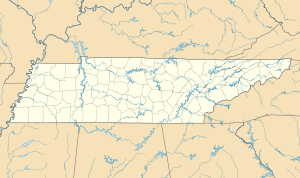
Pinson, Tennessee | |
|---|---|
 Pinson's small commercial strip in 2008 | |
| Coordinates: 35°29′24″N 88°43′14″W / 35.49000°N 88.72056°W | |
| Country | United States |
| State | Tennessee |
| County | Madison |
| Area | |
| • Total | 4.08 sq mi (10.56 km2) |
| • Land | 4.06 sq mi (10.52 km2) |
| • Water | 0.01 sq mi (0.04 km2) |
| Elevation | 381 ft (116 m) |
| Population | |
| • Total | 464 |
| • Density | 114.23/sq mi (44.11/km2) |
| Time zone | UTC-6 (CST) |
| • Summer (DST) | UTC-5 (CDT) |
| ZIP code | 38366[3] |
| Area code | 731 |
| FIPS code | 47-58780 |
Pinson is an unincorporated community in Madison County, Tennessee. It lies along U.S. Route 45 between Jackson and Henderson, just north of the Chester County line, and State Route 197 also passes through the community. It is included in the Jackson, Tennessee Metropolitan Statistical Area.[4]
Pinson is the site of the Pinson Mounds, the largest Middle Woodland period Indian mound group in the United States, and the Pinson Mounds State Archaeological Park dedicated to their study.[5]
- ^ "ArcGIS REST Services Directory". United States Census Bureau. Retrieved October 15, 2022.
- ^ "Census Population API". United States Census Bureau. Retrieved October 15, 2022.
- ^ "Pinson TN ZIP Code". zipdatamaps.com. 2023. Retrieved February 17, 2023.
- ^ "OMB Bulletin No 08-01" (PDF). Office of Management and Budget. November 2007. p. 36 – via National Archives.
- ^ Pinson Mounds State Archaeological Park at Tennessee.gov. Retrieved on May 18, 2006.
