| Pipp Brook | |
|---|---|
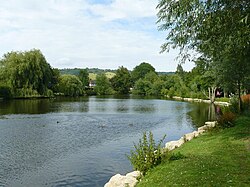
 Pipp Brook Mill Pond, Dorking | |
 | |
| Location | |
| Country | England |
| County | Surrey |
| District | Mole Valley |
| Physical characteristics | |
| Source | Mag's Well |
| • location | Leith Hill, Surrey |
| • coordinates | 51°11′51″N 0°21′46″W / 51.1975°N 0.3628°W |
| • elevation | 219 m (719 ft) |
| Mouth | River Mole |
• location | Pixham |
• coordinates | 51°14′39″N 0°19′08″W / 51.2443°N 0.3189°W |
• elevation | 43 m (141 ft) |
| Length | 9.5 km (5.9 mi) |
| Basin features | |
| Tributaries | |
| • right | Milton Brook |
The Pipp Brook is a left-bank tributary of the River Mole, Surrey, England. It rises at two main springs north of Leith Hill on the Greensand Ridge, then descends steeply in a northward direction, before flowing eastwards along the Vale of Holmesdale. It runs to the north of Dorking High Street, before discharging into the Mole at Pixham.
The Milton Brook, which rises at a tri-forked source lower than that of the Pipp Brook, is the principal tributary.