Town of Pitkin, Colorado | |
|---|---|
 Pitkin, August 2014 | |
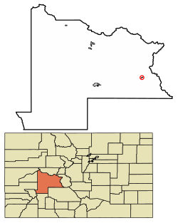
 Location of Pitkin in Gunnison County, Colorado. | |
| Coordinates: 38°36′31″N 106°30′54″W / 38.60861°N 106.51500°W | |
| Country | |
| State | |
| County[1] | Gunnison |
| Incorporated | April 5, 1880[2] |
| Government | |
| • Type | Statutory Town[1] |
| Area | |
| • Total | 0.26 sq mi (0.67 km2) |
| • Land | 0.26 sq mi (0.67 km2) |
| • Water | 0.00 sq mi (0.00 km2) |
| Elevation | 9,229 ft (2,813 m) |
| Population | |
| • Total | 72 |
| • Density | 280/sq mi (110/km2) |
| Time zone | UTC-7 (MST) |
| • Summer (DST) | UTC-6 (MDT) |
| ZIP code[6] | 81241 (PO Boxes) |
| Area code | 970 |
| FIPS code | 08-59830 |
| GNIS feature ID | 2413138[4] |
| Website | townofpitkin |
Pitkin is a Statutory Town in Gunnison County, Colorado, United States. The population was 72 at the 2020 census.[5]
Pitkin was founded in 1879, and is said to be Colorado's first mining camp west of the Continental Divide. Originally named Quartzville, it was renamed to honor Governor Frederick Walker Pitkin.[7]
- ^ a b "Active Colorado Municipalities". State of Colorado, Department of Local Affairs. Archived from the original on December 12, 2009. Retrieved September 1, 2007.
- ^ "Colorado Municipal Incorporations". State of Colorado, Department of Personnel & Administration, Colorado State Archives. December 1, 2004. Retrieved September 2, 2007.
- ^ "2019 U.S. Gazetteer Files". United States Census Bureau. Retrieved July 1, 2020.
- ^ a b U.S. Geological Survey Geographic Names Information System: Pitkin, Colorado
- ^ a b United States Census Bureau. "Pitkin town; Colorado". Retrieved April 23, 2023.
- ^ "ZIP Code Lookup" (JavaScript/HTML). United States Postal Service. Retrieved December 15, 2007.
- ^ History of Pitkin