Placer County, California | |
|---|---|
|
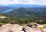
Images from top, left to right: The Auburn Courthouse, a panorama of a forested area, Lake Tahoe in Tahoe Vista | |
 Interactive map of Placer County | |
 Location in the state of California | |
| Coordinates: 39°04′N 120°44′W / 39.06°N 120.73°W | |
| Country | United States |
| State | California |
| Regions | Sacramento Valley, Sierra Nevada |
| Metro area | Greater Sacramento |
| Incorporated | April 25, 1851[1] |
| Named for | Placer mining, a reference to the area being a center of the California Gold Rush |
| County seat | Auburn |
| Largest city | Roseville |
| Government | |
| • Type | Council–CEO |
| • Body | Board of Supervisors[2]
|
| • Chair | Suzanne Jones |
| • Vice Chair | Bonnie Gore |
| • County Executive Officer | Daniel J. Chatigny |
| Area | |
• Total | 1,502 sq mi (3,890 km2) |
| • Land | 1,407 sq mi (3,640 km2) |
| • Water | 95 sq mi (250 km2) |
| Highest elevation | 9,044 ft (2,757 m) |
| Population (2020) | |
• Total | 404,739 |
| • Density | 270/sq mi (100/km2) |
| Time zone | UTC−8 (Pacific Time Zone) |
| • Summer (DST) | UTC−7 (Pacific Daylight Time) |
| Area codes | 530, 916, 279 |
| FIPS code | 06-061 |
| GNIS feature ID | 277295 |
| Congressional district | 3rd |
| Website | www |

Placer County (/ˈplæsər/ PLASS-ər; Placer, Spanish for "sand deposit"), officially the County of Placer, is a county located in the U.S. state of California. As of the 2020 census, the population was 404,739.[4] The county seat is Auburn.[5]
Placer County is included in the Greater Sacramento metropolitan area. It is in both the Sacramento Valley and Sierra Nevada regions, in what is known as the Gold Country. The county stretches roughly 65 miles (105 km) from Sacramento's suburbs at Roseville to the Nevada border and the shore of Lake Tahoe.
- ^ "Placer County". Geographic Names Information System. United States Geological Survey, United States Department of the Interior. Retrieved February 6, 2015.
- ^ "Board of Supervisors | Placer County, CA".
- ^ "Mount Baldy-West Ridge". Peakbagger.com. Retrieved February 6, 2015.
- ^ "Placer County, California". United States Census Bureau. Retrieved January 30, 2022.
- ^ "Find a County". National Association of Counties. Retrieved June 7, 2011.


