| Plaistow | |
|---|---|
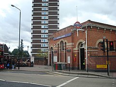
 Plaistow Underground station | |
 Greengate Street, Plaistow | |
Location within Greater London | |
| Population | 31,874 (2011 Census. Plaistow North and South Wards) |
| OS grid reference | TQ405825 |
| London borough | |
| Ceremonial county | Greater London |
| Region | |
| Country | England |
| Sovereign state | United Kingdom |
| Post town | LONDON |
| Postcode district | E13 |
| Dialling code | 020 |
| Police | Metropolitan |
| Fire | London |
| Ambulance | London |
| UK Parliament | |
| London Assembly | |
Plaistow (/ˈplɑːstoʊ/ PLAHST-oh or /ˈplæstoʊ/ PLAST-oh)[1][2] is a inner city area of East London, England, within the London Borough of Newham. It adjoins Upton Park to the north, East Ham to the east, Beckton to the south, Canning Town to the south-west and West Ham to the west.
It was originally a ward in the parish of West Ham, hundred of Becontree, and part of the historic county of Essex. Since 1965, Plaistow has been part of the London Borough of Newham, a local government district of Greater London. The area forms the majority of the London E13 postcode district. Plaistow North and Plaistow South are two of the ten electoral wards making up the UK parliamentary constituency of West Ham.
The main roads are the A112; Prince Regent Lane, Greengate Street, The Broadway, High Street and Plaistow Road, which is a former Roman road; and the A124 (Barking Road), which passes south west/ north east through Plaistow and past the former West Ham United football ground. Commercial and retail premises are on the A112 at Greengate Street leading north and Prince Regent Lane south, leading 0.3 miles (0.5 km) to Newham Sixth Form College and along the A124.
