This article needs additional citations for verification. (December 2023) |
Planaltina | |
|---|---|
| Região Administrativa de Planaltina Administrative Region of Planaltina | |
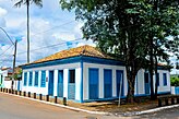
Clockwise from top: Aerial view, Pedra Fundamental, Planaltina bus terminal, Planaltina Regional Hospital, UnB Planaltina Campus, Planaltina Historic Center Museum | |
 Localization of Planaltina in Federal District | |
| Coordinates: 15°37′09″S 47°39′09″W / 15.61917°S 47.65250°W | |
| Country | |
| Region | Central-West |
| State | |
| Founded | August 19, 1859 |
| Government | |
| • Regional administrator | Vicente Salgueiro Baño Salgado[1] |
| Area | |
| • Total | 1,534.69 km2 (592.55 sq mi) |
| Elevation | 1,000 m (3,000 ft) |
| Population (2010)[2] | |
| • Total | 164,939 |
| • Density | 11/km2 (30/sq mi) |
| Demonym | Planaltinense |
| Time zone | UTC−3 (BRT) |
| Postal Code (CEP) | 73300-000 |
| Area code | +55 61 |
| Website | www.planaltina.df.gov.br |
Planaltina (Portuguese pronunciation: [plɐ.nawˈtʃi.nɐ]) is an administrative region in the Federal District in Brazil. It is located in the east of the Federal District, bordering Fercal, Sobradinho, and Itapoã to the west, and Paranoá to the south. With an area of 1.534 square kilometers, it is the largest administrative region of the Federal District.[3] Planaltina has a population of 177.540.[4] The region seat was founded in 1859[5] and is the oldest city in the Federal District.
- ^ "Perfil do administrador" (in Portuguese). Administração Regional de Planaltina, DF. Retrieved 2015-01-01.
- ^ "Pesquisa Distrital por Amostra de Domicílios – 2010/2011" (PDF) (in Portuguese). Codeplan. Retrieved 2012-08-20.[permanent dead link]
- ^ "ATLAS DO DISTRITO FEDERAL 2017" (PDF). Codeplan. 2017. Retrieved 2023-06-16.
- ^ "COMPATIBILIZAÇÃO ENTRE AS PROJEÇÕES POPULACIONAIS, A PDAD 2018 E A NOVA DELIMITAÇÃO (OFICIAL) DAS REGIÕES ADMINISTRATIVAS DO DISTRITO FEDERAL" (PDF). Codeplan (in Brazilian Portuguese). June 2020. Retrieved 2023-06-16.
- ^ Rajab', 'Yasmin (2023-08-19). "Cidade mais antiga do DF, Planaltina completa neste sábado 164 anos". Cidades DF (in Brazilian Portuguese). Retrieved 2023-11-19.


