Pleasant Hill, Iowa | |
|---|---|
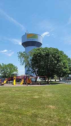
 Pleasant Hill's water tower, with the city logo | |
 Location of Pleasant Hill, Iowa | |
| Coordinates: 41°35′05″N 93°30′59″W / 41.58472°N 93.51639°W | |
| Country | United States |
| State | Iowa |
| County | Polk |
| Area | |
• Total | 10.87 sq mi (28.15 km2) |
| • Land | 10.42 sq mi (26.99 km2) |
| • Water | 0.45 sq mi (1.15 km2) |
| Elevation | 906 ft (276 m) |
| Population (2020) | |
• Total | 10,147 |
| • Density | 973.58/sq mi (375.90/km2) |
| Time zone | UTC-6 (Central (CST)) |
| • Summer (DST) | UTC-5 (CDT) |
| ZIP codes | 50317, 50327 |
| Area code | 515 |
| FIPS code | 19-63525 |
| GNIS feature ID | 2396230[2] |
| Website | www |
Pleasant Hill is a city in Polk County, Iowa, United States. The population was 10,147 at the time of the 2020 census.[3] It is part of the Des Moines metropolitan area. As of July 2005, Pleasant Hill was assigned a ZIP code, 50327.
- ^ "2020 U.S. Gazetteer Files". United States Census Bureau. Retrieved March 16, 2022.
- ^ a b U.S. Geological Survey Geographic Names Information System: Pleasant Hill, Iowa
- ^ "2020 Census State Redistricting Data". census.gov. United states Census Bureau. Retrieved August 12, 2021.