Pleasanton, Nebraska | |
|---|---|
 Pleasanton, looking northwest across the South Loup River | |
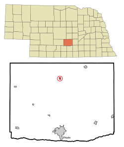
 Location of Pleasanton, Nebraska | |
| Coordinates: 40°58′12″N 99°05′16″W / 40.97000°N 99.08778°W | |
| Country | United States |
| State | Nebraska |
| County | Buffalo |
| Government | |
| • Mayor | Dean Smith |
| Area | |
• Total | 0.35 sq mi (0.92 km2) |
| • Land | 0.35 sq mi (0.92 km2) |
| • Water | 0.00 sq mi (0.00 km2) |
| Elevation | 2,093 ft (638 m) |
| Population (2020) | |
• Total | 361 |
| • Density | 1,016.90/sq mi (392.31/km2) |
| Time zone | UTC-6 (Central (CST)) |
| • Summer (DST) | UTC-5 (CDT) |
| ZIP code | 68866 |
| Area code | 308 |
| FIPS code | 31-39450[3] |
| GNIS feature ID | 2398986[2] |
Pleasanton is a village in Buffalo County in the state of Nebraska in the Midwestern United States. At the 2010 census, its population was 341.
Pleasanton was platted in 1890 when the Union Pacific railroad was extended to that point.[4] It got its name from its location in the Pleasant Valley of the Loup River.[4] Pleasanton was incorporated as a village in 1894.[5][6]
- ^ "ArcGIS REST Services Directory". United States Census Bureau. Retrieved September 18, 2022.
- ^ a b U.S. Geological Survey Geographic Names Information System: Pleasanton, Nebraska
- ^ "U.S. Census website". United States Census Bureau. Retrieved January 31, 2008.
- ^ a b Fitzpatrick, Lillian L. (1960). Nebraska Place-Names. University of Nebraska Press. p. 26. ISBN 0803250606.
- ^ Bassett, Samuel Clay (1916). Buffalo County, Nebraska, and Its People: A Record of Settlement, Organization, Progress and Achievement, Volume 1. S.J. Clarke Publishing Company. p. 283.
- ^ "Pleasanton, Buffalo County". Center for Advanced Land Management Information Technologies. University of Nebraska. Retrieved July 30, 2014.