| Plumas National Forest | |
|---|---|
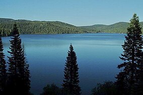
 Bucks Lake in Plumas National Forest | |
Map of California | |
| Nearest city | Quincy, California |
| Coordinates | 40°00′01″N 120°40′05″W / 40.00028°N 120.66806°W |
| Area | 1,146,000 acres (4,640 km2) |
| Established | 1907 |
| Governing body | U.S. Forest Service |
| Website | Plumas National Forest |
Plumas National Forest is a 1,146,000-acre (4,640 km2) United States National Forest located at the northern terminus of the Sierra Nevada, in northern California. The Forest was named after its primary watershed, the Rio de las Plumas, or Feather River.

