The topic of this article may not meet Wikipedia's notability guideline for geographic features. (May 2021) |
Poblacion | |
|---|---|
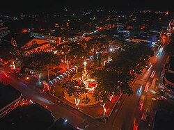
 Rizal Park in Barangay 8, Malaybalay City | |
| Coordinates: 8°9′15.2″N 125°7′44.2″E / 8.154222°N 125.128944°E | |
| Country | |
| Province | |
| City | Malaybalay |
| District | Poblacion |
| Established | June 15, 1877 |
| Barangays | 11
|
| Area | |
| • Total | 11.58 km2 (4.47 sq mi) |
| Elevation | 600 m (2,000 ft) |
| Population (2015) | |
| • Total | 26,579 |
| • Density | 2,300/km2 (5,900/sq mi) |
| Time zone | PST (UTC+8) |
Poblacion District refers to the poblacion (city center) of Malaybalay, Philippines. It is composed of eleven barangays and has an aggregate population of 26,579 and an area of 12.72 square kilometers. It is bounded to the north by Sumpong, to the east by Can-ayan, to the south by Casisang, and to the west by Kalasungay.

