This article needs additional citations for verification. (August 2008) |
| Podocarpus National Park | |
|---|---|
 Trees surrounding the Bombuscaro river | |
| Location | Ecuador Zamora Chinchipe and Loja |
| Nearest city | Loja, Loja, Ecuador |
| Coordinates | 4°17′0″S 79°0′0″W / 4.28333°S 79.00000°W |
| Area | 1462.8 km2 |
| Established | 1982 |
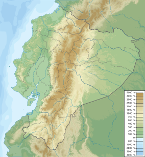
Podocarpus National Park (Spanish: Parque Nacional Podocarpus) is a national park located in the provinces of Zamora Chinchipe and Loja, in the south-east of Ecuador. It was created in 1982.[1]
It covers 1,462.8 square kilometres (564.8 sq mi), from two spurs of the eastern range of the Andes to the basins of the Nangaritza, Numbala, and Loyola rivers. About 85 per cent of the park is in the province of Zamora Chinchipe, and the remainder is in the province of Loja. It is categorized as a megadiverse zone and an area with a high level of endemic species because it is a meeting point between four ecological systems: Northern Andes, Southern Andes, Amazonian, and Pacific.[2] Although considerable knowledge has been gathered about its biodiversity in parts of the area, only a minority of the species inhabiting the park has been discovered so far.[3]
The Podocarpus National Park spans from lower montane rain forests at about 1,000 metres (3,300 ft) elevation, up to high elevation elfin forests at 3,000 metres (9,800 ft). Paramo or subparamo vegetation is found at elevations above 3,000 m (9,800 ft) where a complex of more than 100 lagoons exists, among the best-known being the Lagunas del Compadre.
The park has two main entrances. One is in the Cajanuma Sector, about 8 kilometres (5.0 mi) south of Loja, where elfin forest and paramo habitats at elevations between some 2,900 and 3,500 metres (9,500 and 11,500 ft) can be accessed. The other is in the Bombuscaro Sector, corresponding to the Bombuscaro River, in lower montane forest habitats at elevations from roughly 1,000 metres (3,300 ft) upwards. There are two alternative entrances without park guards. The Romerillos Sector, corresponding to the Jamboé River southeast of the Bombuscaro Sector, is also an entrance for gold miners who work inside the park. Another entrance is at Cerro Toledo, east of the Yangana-Valladolid route in the southwestern part of the park.
- ^ "Andes" at EcuadorExplorer.com
- ^ Cite error: The named reference
guidewas invoked but never defined (see the help page). - ^ Brehm, G.; Homeier, J.; Fiedler, K.; Kottke, I.; Illig, J.; Nöske, N. M.; Werner, F. A.; Breckle, S. W. (2008). "Mountain Rain Forests in Southern Ecuador as a Hotspot of Biodiversity – Limited Knowledge and Diverging Patterns". Gradients in a Tropical Mountain Ecosystem of Ecuador. Ecological Studies. Vol. 198. pp. 15–23. doi:10.1007/978-3-540-73526-7_2. ISBN 978-3-540-73525-0.
