Podporozhsky District
Подпорожский район | |
|---|---|
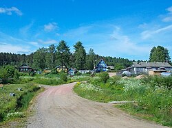
 Kupetskoye | |
 Location of Podporozhsky District in Leningrad Oblast | |
| Coordinates: 60°49′42″N 33°50′51″E / 60.82833°N 33.84750°E | |
| Country | Russia |
| Federal subject | Leningrad Oblast[1] |
| Established | 1 August 1927 |
| Administrative center | Podporozhye[1] |
| Area | |
• Total | 7,679 km2 (2,965 sq mi) |
| Population | |
• Total | 13,000 |
| • Density | 1.7/km2 (4.4/sq mi) |
| • Urban | 62.8% |
| • Rural | 37.2% |
| Administrative structure | |
| • Administrative divisions | 1 settlement municipal formation |
| • Inhabited localities[1] | 1 cities/towns, 3 Urban-type settlements[4], 68 rural localities |
| Municipal structure | |
| • Municipally incorporated as | Podporozhsky Municipal District[5] |
| • Municipal divisions[5] | 4 urban settlements, 1 rural settlements |
| Time zone | UTC+3 (MSK |
| OKTMO ID | 41636000 |
| Website | www |
Podporozhsky District (Russian: Подпоро́жский райо́н) is an administrative[1] and municipal[5] district (raion), one of the seventeen in Leningrad Oblast, Russia. It is located in the northeast of the oblast and borders with Prionezhsky District of the Republic of Karelia in the north, Vytegorsky District of Vologda Oblast in the east, Babayevsky District of Vologda Oblast in the southeast, Tikhvinsky District in the south, Lodeynopolsky District in the southwest, and Olonetsky and Pryazhinsky Districts of the Republic of Karelia in the northwest. In the northeast, the district is bounded by Lake Onega. The area of the district is 7,679 square kilometers (2,965 sq mi), which makes it the largest district in Leningrad Oblast.[2] Its administrative center is the town of Podporozhye.[1] Population (excluding the administrative center): 13,000 (2010 Census);[3] 14,845 (2002 Census);[7] 18,075 (1989 Soviet census).[8]
- ^ a b c d e Oblast Law #32-oz
- ^ a b "Стать туристической Меккой Ленобласти мешают плохие дороги. Фоторепортаж Подробности: http://www.regnum.ru/news/tourism/1549880.html#ixzz2CzYVVw8s Любое использование материалов допускается только при наличии гиперссылки на ИА REGNUM" (in Russian). ИА Регнум. Retrieved November 22, 2012.
{{cite web}}: External link in|title= - ^ a b Russian Federal State Statistics Service (2011). Всероссийская перепись населения 2010 года. Том 1 [2010 All-Russian Population Census, vol. 1]. Всероссийская перепись населения 2010 года [2010 All-Russia Population Census] (in Russian). Federal State Statistics Service.
- ^ The count of urban-type settlements may include the work settlements, the resort settlements, the suburban (dacha) settlements, as well as urban-type settlements proper.
- ^ a b c Law #51-oz
- ^ "Об исчислении времени". Официальный интернет-портал правовой информации (in Russian). June 3, 2011. Retrieved January 19, 2019.
- ^ Federal State Statistics Service (May 21, 2004). Численность населения России, субъектов Российской Федерации в составе федеральных округов, районов, городских поселений, сельских населённых пунктов – районных центров и сельских населённых пунктов с населением 3 тысячи и более человек [Population of Russia, Its Federal Districts, Federal Subjects, Districts, Urban Localities, Rural Localities—Administrative Centers, and Rural Localities with Population of Over 3,000] (XLS). Всероссийская перепись населения 2002 года [All-Russia Population Census of 2002] (in Russian).
- ^ Всесоюзная перепись населения 1989 г. Численность наличного населения союзных и автономных республик, автономных областей и округов, краёв, областей, районов, городских поселений и сёл-райцентров [All Union Population Census of 1989: Present Population of Union and Autonomous Republics, Autonomous Oblasts and Okrugs, Krais, Oblasts, Districts, Urban Settlements, and Villages Serving as District Administrative Centers]. Всесоюзная перепись населения 1989 года [All-Union Population Census of 1989] (in Russian). Институт демографии Национального исследовательского университета: Высшая школа экономики [Institute of Demography at the National Research University: Higher School of Economics]. 1989 – via Demoscope Weekly.

