

| Territorial evolution of Germany in the 20th century |
|---|
| Territorial evolution of Poland in the 20th century |
|---|

The Polish Corridor (German: Polnischer Korridor; Polish: korytarz polski), also known as the Pomeranian Corridor, Danzig Corridor or Gdańsk Corridor, was a territory located in the region of Pomerelia (Pomeranian Voivodeship, Eastern Pomerania), which provided the Second Polish Republic with access to the Baltic Sea, thus dividing the bulk of Weimar Germany from the province of East Prussia. At its narrowest point, the Polish territory was just 30 km wide.[1] The Free City of Danzig (now the Polish cities of Gdańsk, Sopot and the surrounding areas), situated to the east of the corridor, was a semi-independent German speaking city-state forming part of neither Germany nor Poland, though united with the latter through an imposed union covering customs, mail, foreign policy, railways as well as defence.
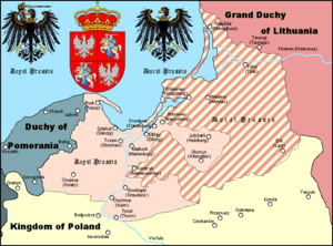
After Poland lost Western Pomerania to Germany in the late 13th century, the area of Eastern Pomerania with the strategically important port of Gdańsk remained a narrow strip of land giving Poland access to the Baltic Sea and was also sometimes referred to as a corridor.[2][3]
- ^ "Польский коридор" in the Great Soviet Encyclopedia (in Russian) – via Great Scientific Library
- ^ A History of Western Civilization: Then came the acquisition of Prussia (separated from Brandenburg by the "Polish corridor") page 382, author Roland N. Stromberg Dorsey Press 1969.
- ^ The Scandinavians in History. "Brandenburg, by the acquisition of Eastern Pomerania besides other territories within the empire was firmly established on the Baltic, though a Polish corridor running between Eastern Pomerania and East Prussia to Danzig denied her all she desired", page 174, author Stanley Mease Toyne. Ayer Publishing 1970