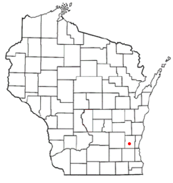
Polk, Wisconsin | |
|---|---|
 Location of Polk, Wisconsin | |
| Coordinates: 43°19′18″N 88°14′10″W / 43.32167°N 88.23611°W | |
| Country | |
| State | |
| County | Washington |
| Incorporated | January 21, 1846 |
| Area | |
| • Total | 32.2 sq mi (83.4 km2) |
| • Land | 31.9 sq mi (82.7 km2) |
| • Water | 0.3 sq mi (0.7 km2) |
| Elevation | 1,122 ft (342 m) |
| Population (2000) | |
| • Total | 3,938 |
| • Density | 123.3/sq mi (47.6/km2) |
| Time zone | UTC-6 (Central (CST)) |
| • Summer (DST) | UTC-5 (CDT) |
| Area code | 262 |
| FIPS code | 55-63875[2] |
| GNIS feature ID | 1583950[1] |
| Website | www |
Polk is a town in Washington County, Wisconsin, United States. The population was 3,938 at the 2000 census. The unincorporated communities of Ackerville, Cedar Creek, Cedar Lake, Diefenbach Corners, Mayfield, and Rugby Junction are located in the town. The town derives its name from James K. Polk, 11th U.S. president, who was in office when the town incorporated in 1846.[3]
- ^ a b "US Board on Geographic Names". United States Geological Survey. October 25, 2007. Retrieved January 31, 2008.
- ^ "U.S. Census website". United States Census Bureau. Retrieved January 31, 2008.
- ^ Cite error: The named reference
Historywas invoked but never defined (see the help page).